

Esri
We partner with Esri, the global market leader in geographic information system (GIS) software and location intelligence, to bring Seerist signal into ArcGIS workflows used by analysts worldwide.
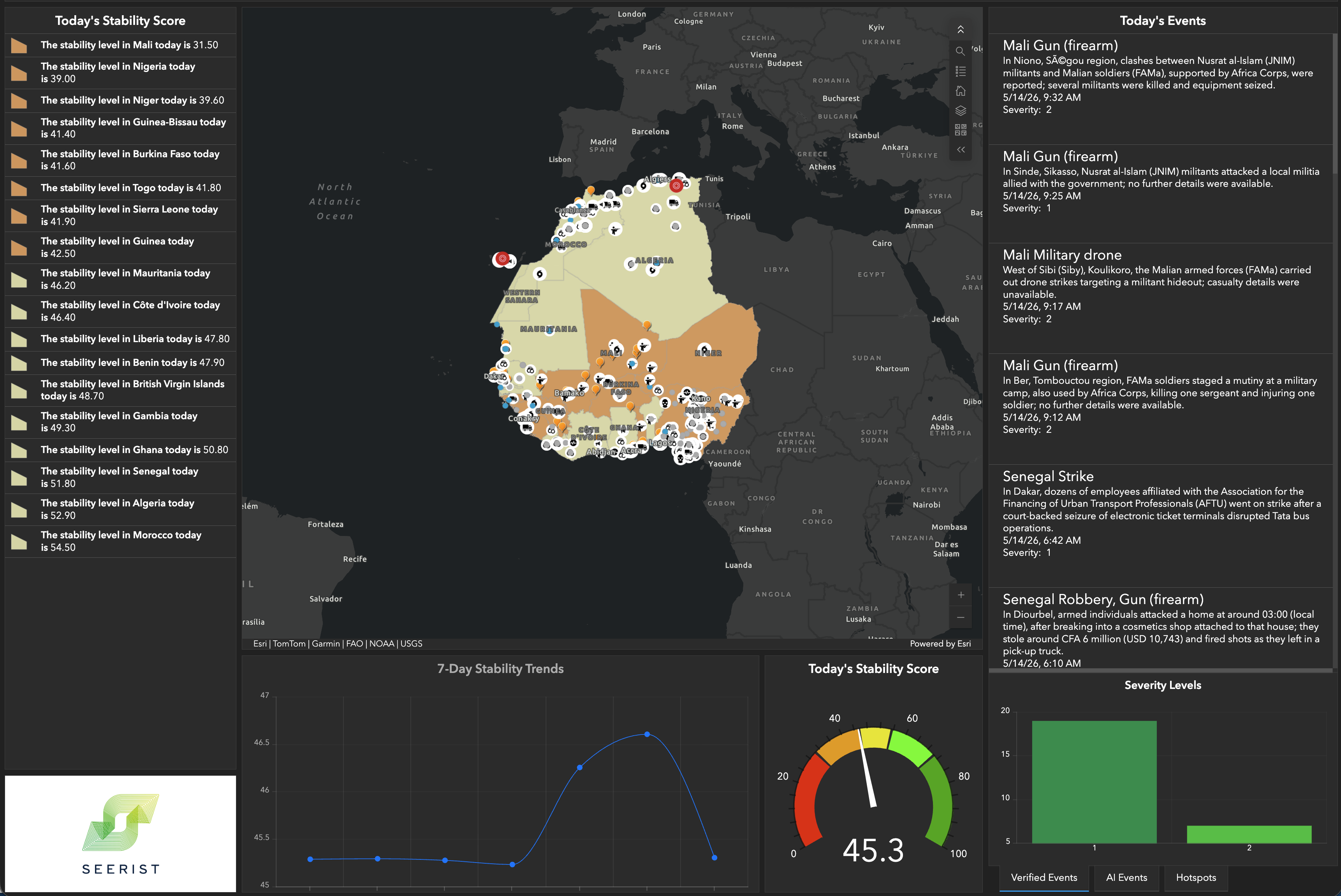
About the partnership
Customise your Esri dashboard with Seerist stability models. The integration puts verified events, hotspots, and stability signal directly into the ArcGIS workflows analysts already live in.
What you get
- Enhanced event monitoring — real-time data integration from millions of OSINT sources, with human-verified incidents to reduce false positives.
- Advanced analytics and reporting — custom alerts keyed to specific criteria such as breaking events categorised by risk type.
- Seamless Esri integration — Seerist is available as Esri Feature Services for easy visualisation and analysis in ArcGIS Online and ArcGIS Pro.
Why it matters
- Identify leading indicators of global events so security and intelligence teams can visualise risk and threat with precision.
- Enhance real-time threat monitoring and situational awareness through integrated dashboards that protect your people and assets.
Easy integration
- Gain insight and situational awareness across your critical areas of interest.
- Monitor city, region, and country stability on the maps you already use.
- Visualise a vast range of incidents across the globe — human-verified and analyst-validated.
- Track patterns of activity that flag disruptive events before they escalate.
Request a demo to see Seerist + ArcGIS running side-by-side on a live operating picture.
See Esri + Seerist in action.
Talk to us about how the Esri partnership fits into your operating picture.